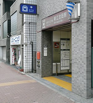
Shin-egota Station
Appearance
E34 Shin-egota Station 新江古田駅 | |||||||||||
|---|---|---|---|---|---|---|---|---|---|---|---|
 Entrance A2 to Shin-egota Station in May 2010 | |||||||||||
| General information | |||||||||||
| Location | 2-29-13 Ehara-chō, Nakano City, Tokyo 165-0023 Japan | ||||||||||
| Operated by | |||||||||||
| Line(s) | E Ōedo Line | ||||||||||
| Distance | 5.4 km (3.4 mi) from Hikarigaoka | ||||||||||
| Platforms | 1 island platform | ||||||||||
| Tracks | 2 | ||||||||||
| Construction | |||||||||||
| Structure type | Underground | ||||||||||
| Other information | |||||||||||
| Station code | E-34 | ||||||||||
| Website | Official website | ||||||||||
| History | |||||||||||
| Opened | 19 December 1997 | ||||||||||
| Passengers | |||||||||||
| FY2011 | 22,697 daily | ||||||||||
| Services | |||||||||||
| |||||||||||
| |||||||||||
Shin-egota Station (新江古田駅, Shin egota eki) is a subway station on the Toei Ōedo Line in Nakano, Tokyo, Japan, operated by the Tokyo subway operator Tokyo Metropolitan Bureau of Transportation (Toei).
Lines
[edit]Shin-egota Station is served by the Toei Ōedo Line, and lies 5.4 km (3.4 mi) from the starting point of the line at Hikarigaoka.[1] The station is numbered "E-34".
Station layout
[edit]The station has one island platform on the second basement ("B2F") level, serving two tracks.
Platforms
[edit]| 1 | E Ōedo Line | for Tochōmae, Roppongi, and Daimon |
| 2 | E Ōedo Line | for Nerima and Hikarigaoka |
-
The ticket gates in May 2010
-
The platforms in December 2019
History
[edit]The station opened on 19 December 1997.[1]
Passenger statistics
[edit]In fiscal 2011, the station was used by an average of 22,697 passengers daily.[1]
Surrounding area
[edit]- Egota-no-Mori Park
- Nihon University College of Art
- Musashi University
- Musashi Junior & Senior High School
See also
[edit]References
[edit]- ^ a b c Terada, Hirokazu (19 January 2013). データブック日本の私鉄 [Databook: Japan's Private Railways] (in Japanese). Japan: Neko Publishing. p. 218. ISBN 978-4-7770-1336-4.
External links
[edit]Wikimedia Commons has media related to Shin-egota Station.
- Official website (in Japanese)


